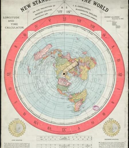
Alexander Gleason's new standard flat map of the Earth in 1892.

Professor Ferguson’s Flat Land Map (Bible) is still stored at the US Library of Congress https://www.loc.gov/item/2011594831/ in 1893, 130 years ago, showing that, There are 4 angels guarding the 4 corners (gates). The map comes with 400 Bible verses and a small picture on the right side to destroy the ball that rotates and flies in space.

Old map of Japan from 1785. Continents and islands “to the north” (the caption says it is the Land of the Night People), Magallanica (current name Antarctica) with green hills, Sahara with rivers and green hills, Australia part of Magallanica, Greenland is Fulantea.
Everything we see today on modern maps is a lie… If you have followed me for a long time, you will know what I am talking about with the unreal lands on modern maps… And We believe it too much because we don’t have the mindset to ask questions… I will repost for those who are new here and have inboxes asking about this.
And will post about Japan, the stronghold of the Eastern Deep State.

